
History of the East Sea
History of the East Sea
• The waters of East sea consists of territorial waters and EEZ(Exclusive Economic Zone) of 4 countries, South and North Korea, Japan and Russia.
• The appellation of East Sea appeared firstly in an article of King Dongmyeong of annals of Goguryeo(around 50 B.C) in Samguk Sagi and was mentioned quite often in various literature and maps in Korea including the Great King Gwanggeto Stele, Paldochongseo (the Map of Eight Provinces) and Agukchongdo(the Map of Joseon). Above all, the name of East Sea was used 700 years earlier than the name of Japan as the origin of the name, Sea of Japan.

…………………………………………………………..
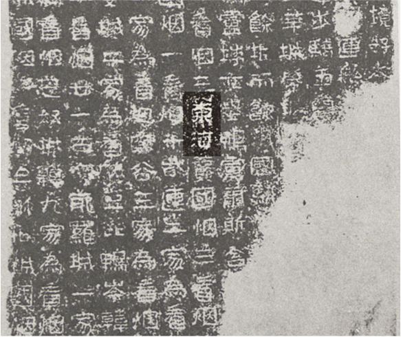
East Sea in Samguksagi
…………………………………………………………….
International Hydrographic Bureau(IHB), being established in 1921 to aim at preparing international norms for international standardization of maritime geographical name and the safe navigation, published a book, Limits of Oceans and Seas(S-23) in 1929, followed from long discussions for many years. On the basis of this book, Sea of Japan as a dominant appellation was commonly adopted in international society. Nevertheless, Korea could not express the opinion internationally on the appellation of the sea because, then, Korea was under the Japanese colonial rule. Afterwards, the second(1937) and the third(19530 edition of Limits of Oceans and Seas(S-23) were published in turns, still yet the sea was recorded as Sea of Japan appellation in the books. Unfortunately, as Korea was colonized by Japan or went through civil war at the time, Korea was not able to take part in the decision-making progress. It was not until 1992 after entering United Nation in 1991 that Korean government raised the issue of East Sea appellation officially toward international society at United Nations Conference on the Standardization of Geographical Names (UNCSGN). From that time onward, Korean government has kept trying to recover the name of East Sea.
Internationally, it is recommended that the geographical name of the topographical feature shared with multination should be decided according to the agreement of the involved parties and if impossible, names used in each country should be marked side by side. This basic principle is reaffirmed in the resolutions of the International Hydrographic Organization(IHO) and the United Nations Conference on the Standardization of Geographical Names (UNCSGN).
International Hydrographic Bureau(IHB), being established in 1921 to aim at preparing international norms for international standardization of maritime geographical name and the safe navigation, published a book, Limits of Oceans and Seas(S-23) in 1929, followed from long discussions for many years. On the basis of this book, Sea of Japan as a dominant appellation was commonly adopted in international society.
Nevertheless, Korea could not express the opinion internationally on the appellation of the sea because, then, Korea was under the Japanese colonial rule. Afterwards, the second(1937) and the third(19530 edition of Limits of Oceans and Seas(S-23) were published in turns, still yet the sea was recorded as Sea of Japan appellation in the books. Unfortunately, as Korea was colonized by Japan or went through civil war at the time, Korea was not able to take part in the decision-making progress.
It was not until 1992 after entering United Nation in 1991 that Korean government raised the issue of East Sea appellation officially toward international society at United Nations Conference on the Standardization of Geographical Names (UNCSGN). From that time onward, Korean government has kept trying to recover the name of East Sea.
…………………………………………………………………………….
1. 동해의 지형적 특성 :
동해수역은한국, 북한, 일본, 러시아등 4개국의영해와배타적경제수역(EEZ)으로구성되어있다.
2. 동해의 명칭 :
동 해명칭은『삼국사기(三國史記)』동명왕본기(기원전 50년경)에서부터등장하여광개토대왕릉비(廣開土大王陵碑), 팔도총도(八道總圖), 아국총도(我國總圖)를비롯하여한국의수많은문헌, 고지도등에기록되어있다. 또한동해는 ‘일본해’ 명칭의근원이라할수있는일본이라는국호의등장보다도 700년이나앞서사용된명칭이다.
…………………………………………………………………
[삼국사기] 권13 고구려본기동명성왕조의 동해(東海)
………………………………………………………………..
………………………………………………………
광개토왕릉비에기록된동해(東海)
……………………………………………………..
의 (18세기) 아시아지도 (동해·한국해-THE EASTERN OR COREA SEA)")
……………………………………………………………….
J. 세닉스(John Senex)의 (18세기) 아시아지도 (동해·한국해-THE EASTERN OR COREA SEA)
……………………………………………………………….